
Upper Ganga Canal
Asset Management System
A practical guide to navigating the UGCAMS geoportal, exploring the canal network, analysing spatial information and managing mapped infrastructure assets.
Getting Started with UGCAMS
UGCAMS provides a centralized GIS environment for viewing the Upper Ganga Canal network, exploring divisions, analysing spatial information and accessing mapped infrastructure assets.
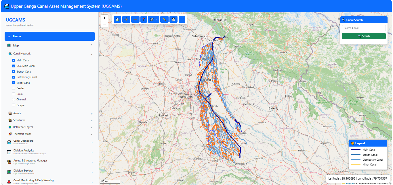
Main Portal Navigation
The main portal provides the interactive map workspace together with navigation controls for accessing the available UGCAMS applications.
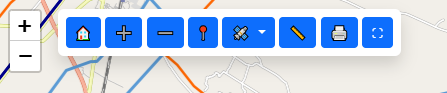
Map Controls and Layer Management
The map interface is the primary spatial workspace of UGCAMS. Layer controls allow users to switch thematic information on or off and review the corresponding spatial information.
Basic Workflow
- Open the map and layer controls.
- Select the required thematic layer.
- Switch layers on or off as required.
- Review the resulting spatial information on the map.
Searching the Canal Network
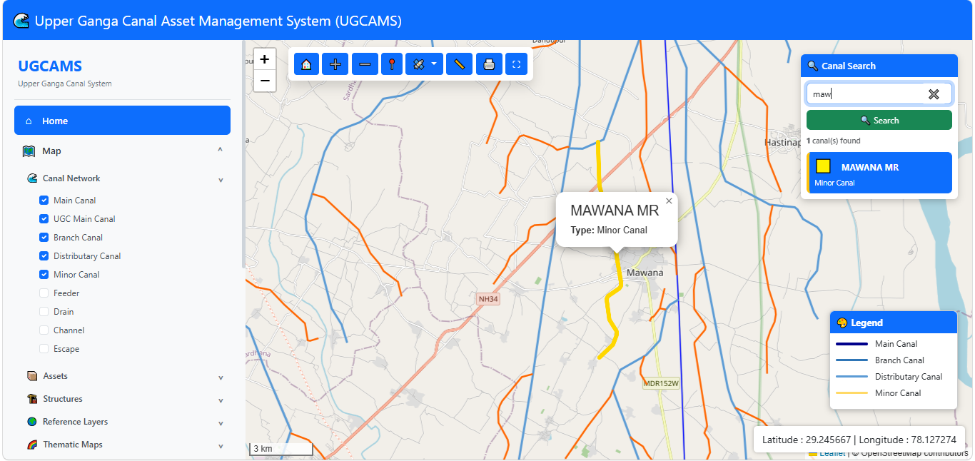
The Canal Search function allows users to locate canal features through the search interface.
How to Search
- Open Search Canal.
- Enter the canal name or relevant search text.
- Select Search.
- Review the returned feature information and map location.
Canal Network Dashboard
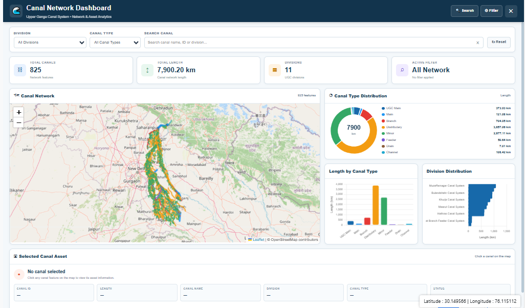
Canal Dashboard provides an interactive summary of the mapped canal network and associated network statistics.
How to Use
- Open Canal Dashboard from the portal navigation.
- Review the dashboard cards and displayed network statistics.
- Use the information as an overview before proceeding to detailed spatial exploration.
Division-wise Spatial Analytics
Division Analytics provides division-wise decision support and thematic analysis. Users can select a division and examine available spatial and environmental information.
Analytics Main Screen
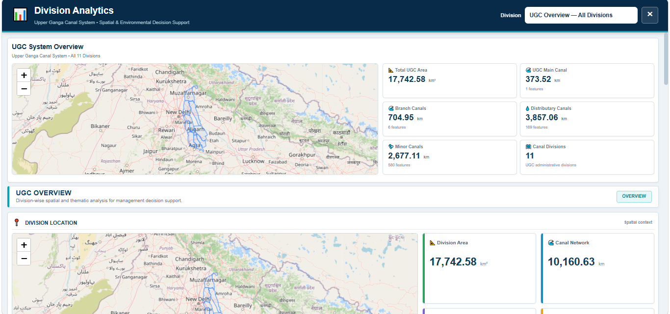
Step 1 — Open Division Analytics
Select Division Analytics from the portal navigation to open the analytics workspace.
Step 2 — Select a Division
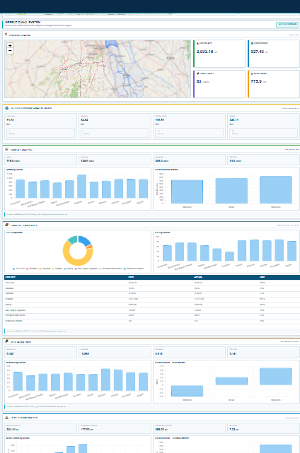
Select the required division from the division selector. The selected division becomes the spatial context for the available analytics.
Step 3 — Thematic Analysis
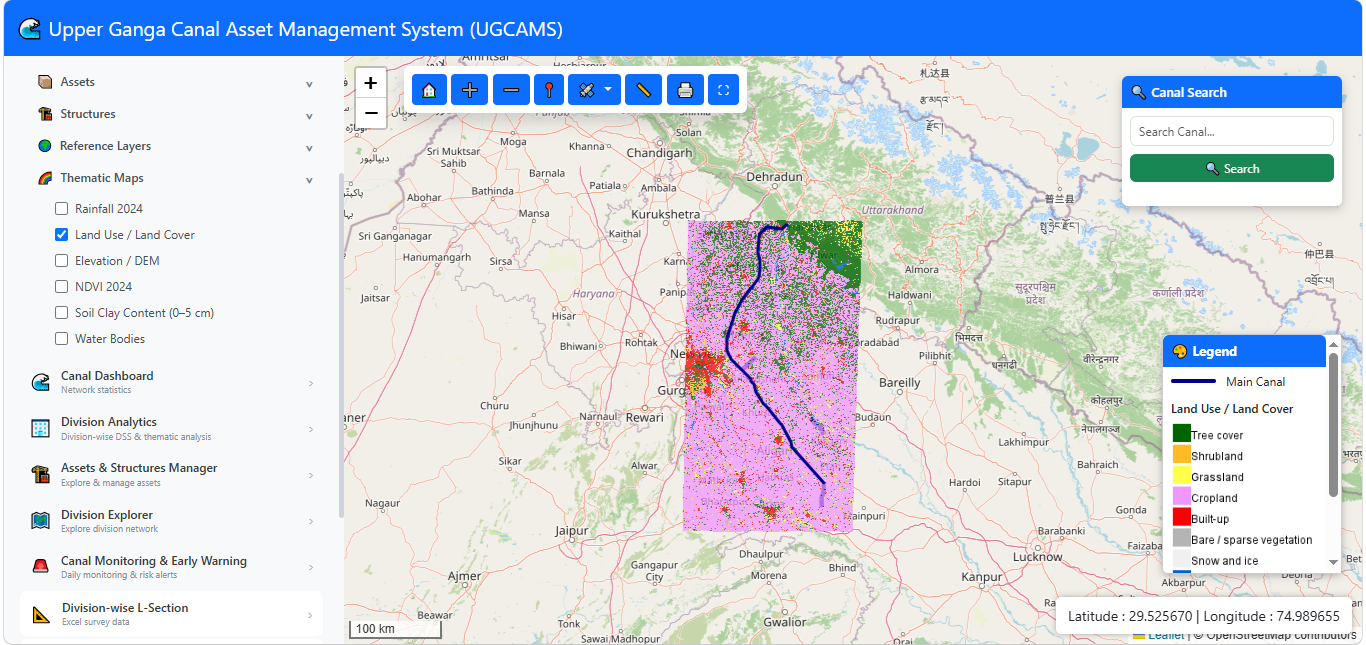
Select the required thematic analysis option and review the resulting spatial representation and analytical information.
Managing Mapped Infrastructure Assets
Assets & Structures Manager provides access to mapped canal-associated infrastructure assets and structures available within UGCAMS.
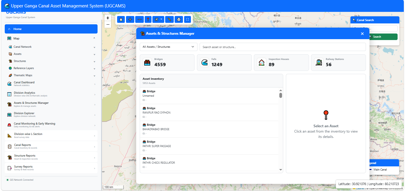
Step 1 — Open the Manager
Select Assets & Structures Manager from the Management section.
Step 2 — Review Mapped Assets
Review the available asset categories and their spatial distribution.
Asset Information
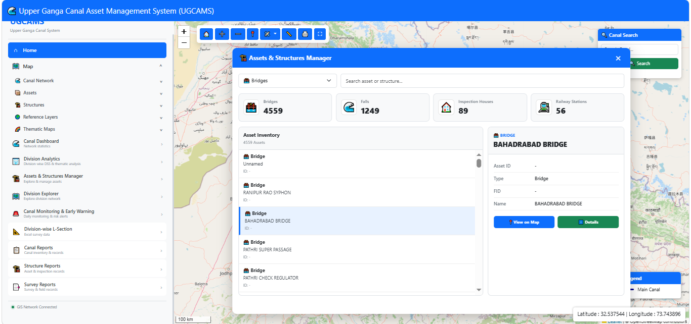
Step 3 — View Asset Details
Select an asset to inspect its associated information and detail view within the geographic context of the portal.
Division-wise Network Exploration
Division Explorer is designed for exploring the canal network and associated mapped information division-wise.
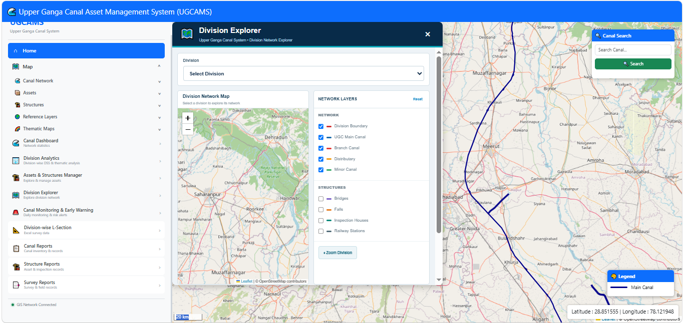
Step 1 — Open Division Explorer
Select Division Explorer from the Management section.
Step 2 — Explore a Division
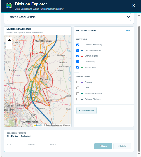
Select the required division and inspect its canal network and associated mapped information using the interactive map.
Canal Monitoring & Early Warning
The Canal Monitoring & Early Warning module forms part of the UGCAMS application structure. Detailed operating instructions will be added when the module becomes fully operational.
Reporting Functions
UGCAMS provides access to structured reporting and survey information associated with the canal network and its divisions.
Division-wise L-Section
The Division-wise L-Section function provides access to available L-Section survey records division-wise. Users can select a division, view the available L-Sections and open the associated PDF survey document.
Step 1 — Open Division-wise L-Section
From the portal sidebar, open the Reports section and select Division-wise L-Section. The L-Section dashboard displays the available UGC divisions together with the number of L-Sections available for each division.
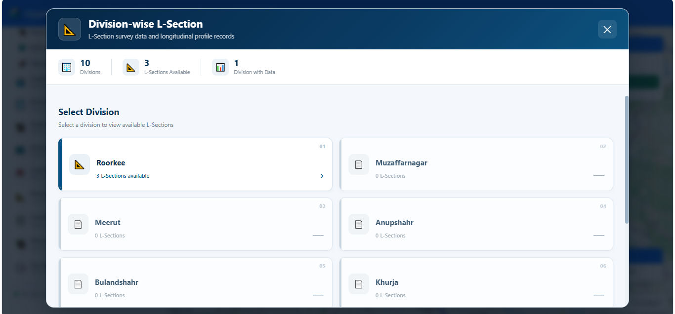
Step 2 — Select a Division
Select the required division from the division cards. The selected division opens a list of the L-Sections currently available for that division.
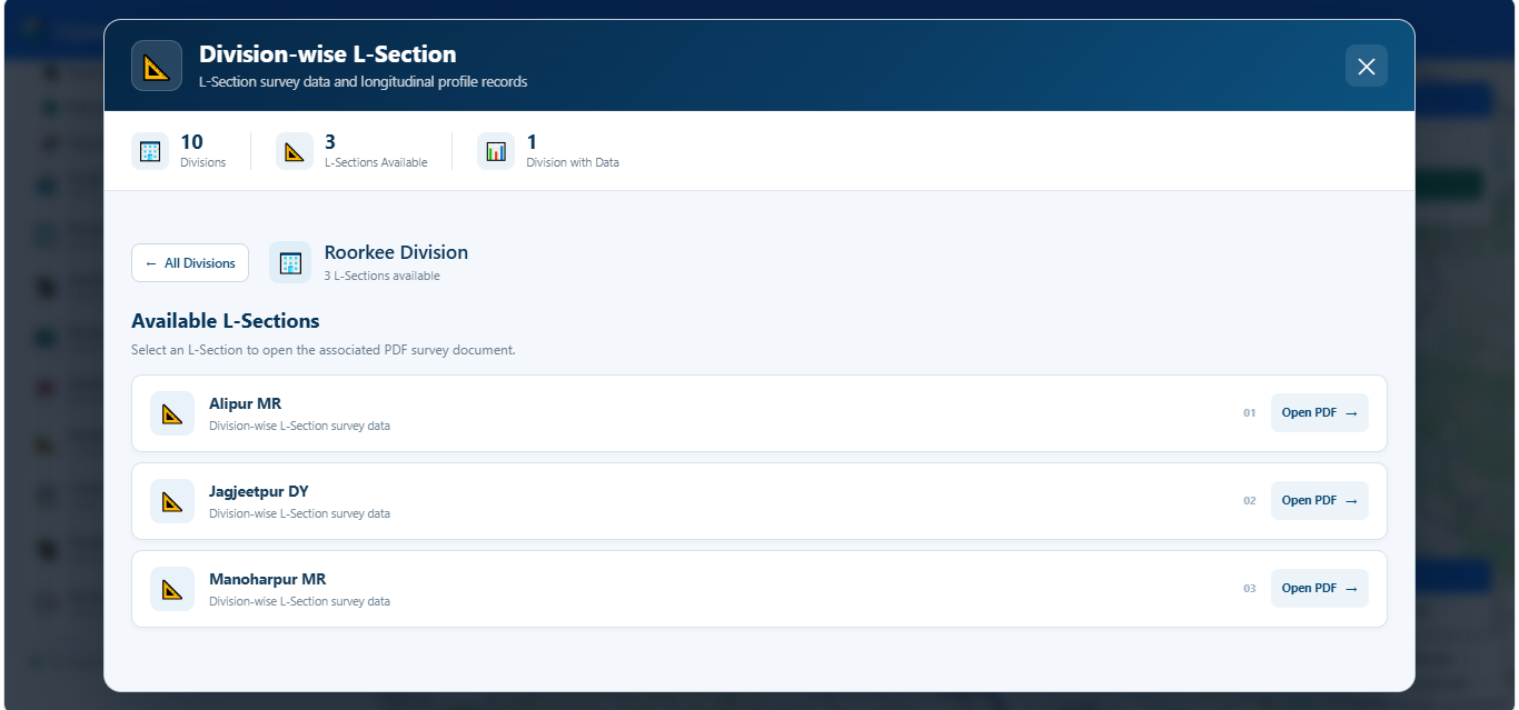
Divisions where no L-Section has been uploaded are clearly indicated as having no L-Sections available.
Step 3 — Select an L-Section
After selecting a division, the available L-Sections are displayed as individual records. Select the required canal L-Section and click Open PDF to view its survey document.
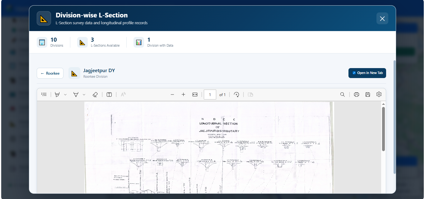
Step 4 — View the L-Section PDF
The selected L-Section survey document opens directly within the UGCAMS PDF viewer. Users can review the document using the available PDF navigation and viewing controls.
Use the Back button to return to the selected division. The All Divisions option can be used to return to the division selection screen.
Available Reporting Functions
UGCAMS Operational Workflow
This manual reflects the currently available UGCAMS portal interfaces. It should be updated as additional monitoring, reporting and decision-support workflows become operational.
↗ Open UGCAMS Portal