
UGCAMS
Upper Ganga Canal Asset Management System
A GIS-based geoportal for integrated canal network visualization, asset management, spatial analysis and decision support.
An Historic Irrigation System with a Lasting Regional Legacy
The Upper Ganga Canal is one of India's landmark achievements in large-scale hydraulic engineering. Conceived to provide dependable irrigation to the Ganga–Yamuna Doab, the system has evolved over nearly two centuries into an extensive network of canals, hydraulic structures and water-control infrastructure.
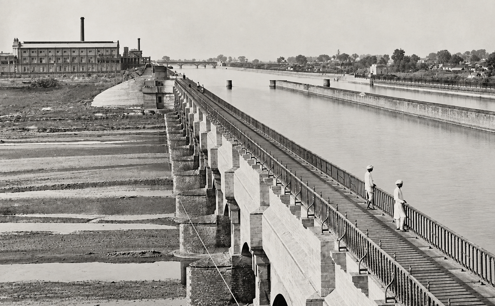
From Vision to Hydraulic Infrastructure
The Upper Ganga Canal emerged from the need to establish a dependable irrigation system for the agriculturally important Ganga–Yamuna Doab. Engineer Sir Proby Thomas Cautley undertook extensive surveys during the late 1830s, laying the foundation for one of the most ambitious hydraulic engineering projects of nineteenth-century India.
Initial construction works commenced in 1842, followed by a major construction programme in the late 1840s. The canal was formally opened in April 1854, with irrigation commencing after trials and improvements in May 1855.
Beyond Irrigation — A Regional Development System
Irrigation has remained the principal purpose of the Upper Ganga Canal. Over its long history, however, the canal corridor and its associated infrastructure have supported a wider range of economic, industrial and social activities.
Irrigation
Reliable water supply supporting agriculture and productive command areas.
Navigation
Navigation was incorporated into parts of the historical canal system.
Hydropower
Canal falls have subsequently supported small hydropower generation.
Industry
Hydraulic energy and dependable water helped support mills and industrial activity.
Water Supply
The canal system has also contributed to domestic and industrial water requirements.
Fisheries
Canal environments have supported fisheries and associated livelihood activities.
Ghats & Culture
Canal and river environments are associated with bathing, washing and cultural activities.
Tourism & Recreation
Historic infrastructure and the canal corridor contribute to recreation and tourism potential.
A Historic System with Contemporary Relevance
Nearly two centuries after its conception, the Upper Ganga Canal continues to form an important part of the region's water and agricultural infrastructure.
The system has evolved through successive improvements, modernisation works and the development of associated hydraulic and power infrastructure. Its extensive network continues to require coordinated operation, maintenance, monitoring and asset management.
Modernisation initiatives continue to improve hydraulic capacity, cross-drainage infrastructure and operational performance while maintaining the functionality of this historic canal system.
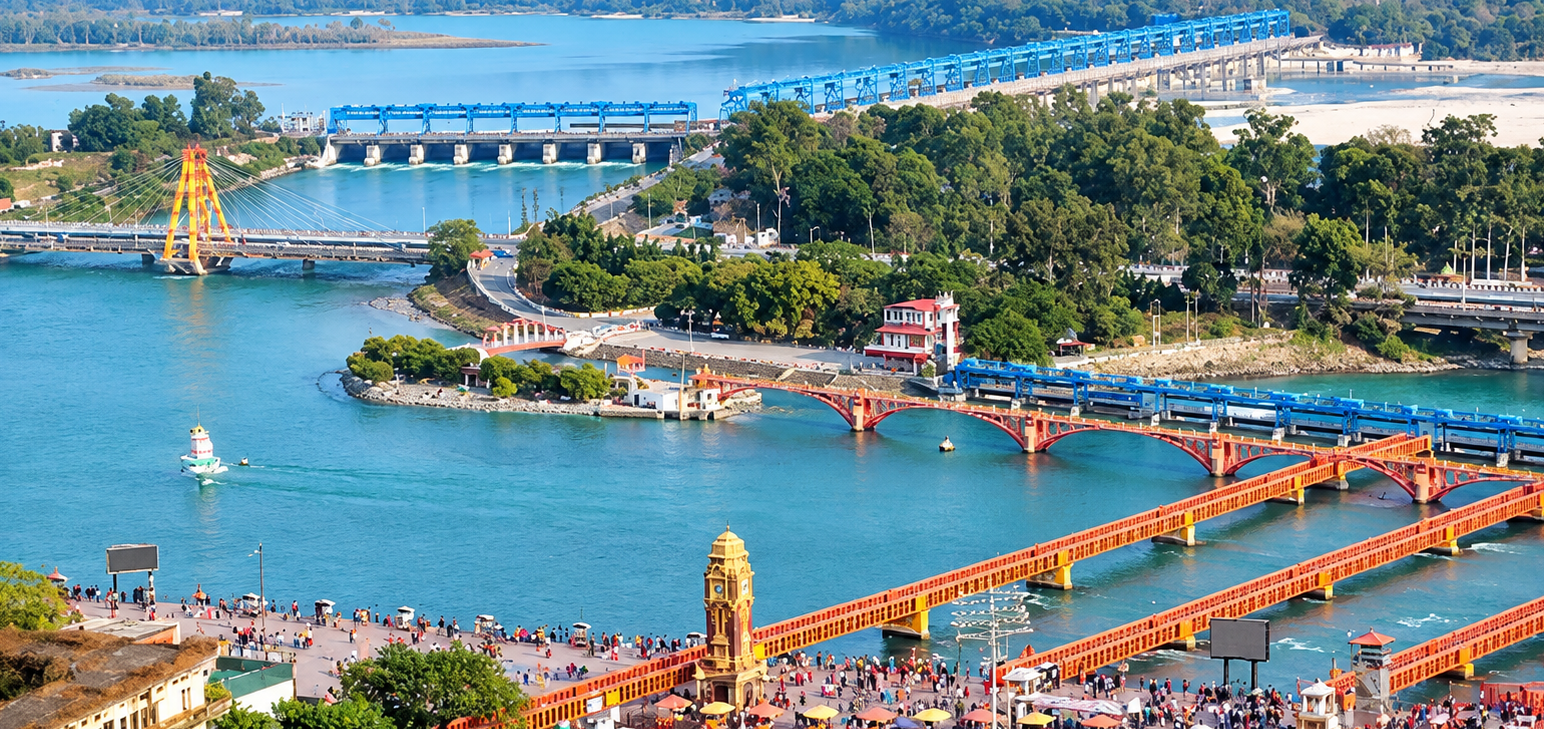
A Network Built Around Water Control & Distribution
The Upper Ganga Canal is not a single channel but an interconnected hydraulic system. Its main canal, branches, distributaries and minors are supported by a wide range of structures required to convey, regulate, cross and distribute water.
Managing a system of this scale requires modern geospatial intelligence.
UGCAMS brings the canal network, divisions, assets, structures and thematic information together within a unified geospatial environment, providing a foundation for visualization, spatial analysis, monitoring, reporting and informed decision-making.
A Geospatial View of the Upper Ganga Canal System
UGCAMS provides a unified geospatial view of the Upper Ganga Canal system, bringing together its canal network, administrative divisions and mapped infrastructure assets within a single digital environment. The platform organizes spatial information to provide a clear overview of the scale, distribution and composition of the canal system.
Canal Network
Mapped Infrastructure
Figures represent the current mapped GIS inventory within UGCAMS and may be updated as the system is progressively enhanced.
From Departmental Records to a Geospatial Decision Platform
UGCAMS was developed through a structured GIS workflow that combines original departmental records, field-surveyed control points, engineering information and thematic spatial datasets. The resulting geospatial database forms the foundation of the integrated web-based UGCAMS platform.
Collection of Departmental Records
Original departmental layout maps of the Upper Ganga Canal system were collected from the concerned departments and field offices. These records, available primarily in large-format chadar map sheets, formed the foundational spatial reference for developing the digital canal network.
Scanning & Map Preservation
The large-format departmental maps were systematically scanned at appropriate resolution. Care was taken to preserve the original map content and minimize stretching, distortion and loss of spatial information during digitization preparation.
RTK-DGPS Control Point Survey
Control points were established at identifiable locations on the departmental maps. Their geographic coordinates were surveyed using Trimble RTK-DGPS, providing field-based positional control for accurate spatial referencing of the scanned maps.
Georeferencing & Spatial Referencing
The surveyed control-point coordinates were used to georeference the scanned departmental maps within the GIS environment. This established a consistent spatial reference for subsequent digitization and integration with other geospatial datasets.
L-Section & Engineering Data Integration
L-sections of individual canals were procured from the concerned divisions, sub-divisions and field offices. These engineering records were examined and associated with the corresponding canal network to support canal-wise referencing and subsequent analysis.
GIS Digitization & Database Creation
The georeferenced maps and engineering information were used to digitize the canal hierarchy and associated mapped features. Spatial and attribute information was organized into structured GIS layers covering canals, administrative divisions and infrastructure assets.
Data Standardization & QA/QC
The GIS datasets were subjected to spatial and attribute quality checks, including geometry validation, connectivity checks, duplicate-feature identification, positional consistency and attribute standardization. This established a consistent database structure for division-wise and canal-wise use.
Integration of Supporting Spatial Data
Supporting geospatial datasets such as administrative boundaries, DEM, rainfall, land use/land cover, NDVI, soil and other thematic information were prepared and integrated into the GIS environment to provide spatial context for environmental and terrain-related analysis.
Spatial & Thematic Analysis
GIS-based spatial analysis techniques were applied to the integrated database, including spatial overlays, division-wise and canal-wise querying, thematic visualization, network statistics and analysis of terrain and environmental parameters. Analytical results were organized into interactive maps, charts and statistical summaries.
Web GIS & UGCAMS Development
The processed GIS database and analytical outputs were integrated into a web-based GIS environment to develop UGCAMS. The platform brings together interactive mapping, canal inventory, asset information, division-wise exploration, thematic analysis, monitoring and reporting within a unified interface.
Integrated Geospatial Decision-Support Environment
A centralized GIS-based environment for visualizing, exploring, analysing and managing the Upper Ganga Canal system and its mapped assets.
Turning Canal Data into Geospatial Intelligence
UGCAMS brings together spatial data, canal infrastructure information and thematic datasets within a unified GIS environment. Its capabilities support visualization, exploration, analysis, monitoring and reporting across the Upper Ganga Canal system.
Integrated Canal Network Visualization
Visualize the Upper Ganga Canal network and its hierarchy within a unified interactive map, providing a clear spatial understanding of divisions, canals and associated infrastructure.
Spatial Asset Inventory
Maintain and explore the mapped inventory of bridges, falls, inspection houses, railway stations and other associated infrastructure through their geographic location and attribute information.
Canal & Division-wise Exploration
Explore the canal system by administrative division and canal hierarchy, allowing users to focus on specific geographic areas and examine their associated spatial information.
GIS-based Spatial Analysis
Apply GIS techniques such as spatial querying, overlays, thematic interpretation and statistical analysis to understand relationships between the canal network, infrastructure and surrounding geographic conditions.
Thematic & Environmental Analysis
Integrate and interpret thematic datasets such as rainfall, land use and land cover, NDVI, DEM and soil information to provide spatial context for environmental and terrain-based assessment.
Interactive Analytics & Statistics
Convert spatial datasets into interactive charts, summaries and division-wise statistics, helping users understand the distribution and characteristics of the canal system and its surrounding conditions.
Monitoring & Early Warning
Provide a spatial framework for monitoring canal-related conditions and highlighting areas requiring attention, supporting timely review and operational decision-making.
Spatial Reporting & Decision Support
Transform mapped information and analytical results into maps, summaries and reports that support planning, assessment and informed management of the canal system.
Visualize. Explore. Analyse. Monitor. Decide.
These capabilities work together to transform dispersed spatial and engineering information into an accessible, structured and interactive geospatial environment for Upper Ganga Canal management.
One Portal. Multiple Management Applications.
UGCAMS organizes its geospatial information and analytical functions into dedicated applications, enabling users to explore the canal network, examine assets, perform division-wise analysis, monitor conditions and access structured reports.
Canal Dashboard
Provides an overview of the Upper Ganga Canal network through key network statistics, canal inventory and summarized spatial information.
Division Explorer
Enables users to explore the canal network and associated infrastructure according to administrative divisions, providing focused spatial and attribute-based access.
Division Analytics
Provides division-wise thematic and spatial analysis using datasets such as rainfall, LULC, NDVI, DEM and soil, along with canal network statistics and interactive analytical outputs.
Assets & Structures Manager
Provides a spatial inventory and management interface for mapped infrastructure and structures associated with the canal system.
Canal Monitoring & Early Warning
Provides a dedicated environment for monitoring canal conditions, identifying areas requiring attention and supporting timely operational review.
Reports
Provides structured access to spatial and engineering information through division-wise, canal, structure and survey-related reporting.
A Unified Gateway to the UGC Geospatial Database
Each application works with the underlying UGCAMS geospatial database, allowing spatial information to be accessed through different operational and analytical perspectives while maintaining a common geographic reference.
Integrated Engineering & Infrastructure Consultancy
IREC (Infra Research Engineering & Consulting), established in 2015, is an integrated engineering and infrastructure consultancy with 11+ years of experience across major infrastructure projects in India.
IREC has undertaken assignments associated with Indian Railways, RVNL, IRCON, IIT Kanpur and other IIT consortiums, C-Ganga, the National Institute of Hydrology and Government Departments, building experience across diverse and technically demanding infrastructure requirements.
Our multidisciplinary approach combines engineering expertise, field experience, data and specialist capabilities to develop practical, reliable solutions tailored to each project.
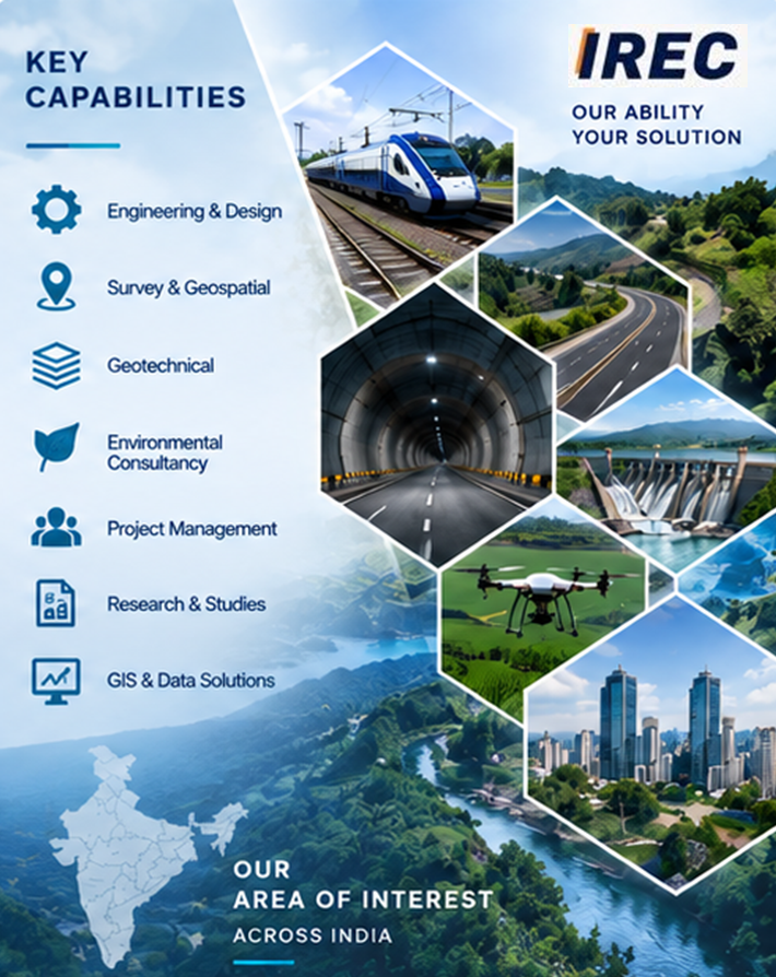
The UGCAMS platform reflects this multidisciplinary approach by bringing together engineering information, field-based spatial data and GIS technologies within an integrated geospatial environment.
Explore UGCAMS with Ease & Clarity
The UGCAMS portal is organized into a structured set of mapping, analysis, asset management, monitoring and reporting functions. Follow the portal sequence below to understand the available tools and applications.
Home
PORTAL STARTThe Home interface provides the starting point for accessing the UGCAMS portal and its major GIS applications.
Map
GIS MAPPINGThe Map section provides access to the primary spatial layers used for viewing and exploring the Upper Ganga Canal system.
Canal Dashboard
NETWORK OVERVIEWView key statistics and an overview of the mapped Upper Ganga Canal network and its associated inventory.
Division Analytics
SPATIAL ANALYTICSExplore division-wise spatial information, thematic analysis, statistics and decision-support information.
Assets & Structures Manager
ASSET MANAGEMENTExplore mapped infrastructure assets and access associated asset information.
Division Explorer
NETWORK EXPLORATIONExplore the canal network and associated mapped information on a division-wise basis.
Canal Monitoring & Early Warning
MONITORINGProvides a framework for canal monitoring, risk identification and early-warning workflows.
Reports
DOCUMENTATIONProvides access to structured canal, structure, survey and division-wise reporting functions.
Need detailed instructions and screenshots?
📖 View Detailed User Manual →